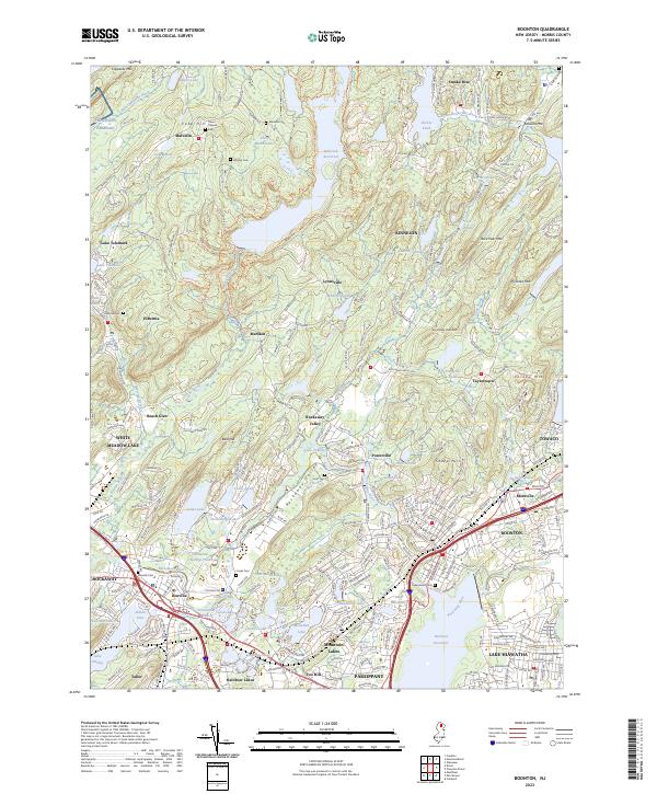
2023 Map of Boonton
USGS Topo · Published 2023About this map
Wildcat Ridge and the Stony Brook Mountains dominate the central landscape of this Morris County region, where the rugged terrain has historically dictated the patterns of local settlement. The Rockaway River winds through the southern half of the quadrangle, passing through the established community of Boonton and near the Boonton Reservoir. This area is characterized by numerous glacial lakes and man-made reservoirs, including the expansive Splitrock Reservoir and smaller bodies like Stickle Pond and Lake Ricabear.
Find a feature on this map
281 named features on this map. Tap any name to fly to it.
Don’t see what you’re looking for? This feature index may not catch every label — zoom into the map to look around manually.
Map Details
Editions of this 2023 Boonton Map
This is the sole edition of this map. No revisions or reprints were ever made.
Other maps of this area

1888 · Franklin
USGS Topo · 1:62,500

1888 · Morristown
USGS Topo · 1:62,500

1888 · Lake Hopatcong
USGS Topo · 1:62,500

1891 · Greenwood Lake
USGS Topo · 1:62,500

1893 · Greenwood Lake
USGS Topo · 1:62,500

1894 · Morristown
USGS Topo · 1:62,500

1894 · Lake Hopatcong
USGS Topo · 1:62,500

1894 · Franklin
USGS Topo · 1:62,500

1897 · Franklin
USGS Topo · 1:62,500

1898 · Lake Hopatcong
USGS Topo · 1:62,500
Featured Places
- Parsippany-Troy Hills, NJ
- Rockaway Township, NJ
- Montville Township, NJ
- Denville Township, Denville
- Denville, NJ