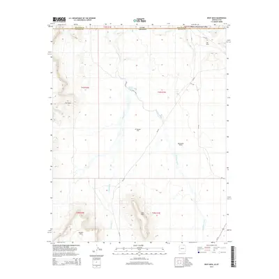
2014 Map of Boot Mesa
USGS Topo · Published 2014About this map
Oljato-Monument Valley straddles the high desert border where Utah and Arizona meet, defined by its iconic sandstone formations and wide drainage basins. The landscape is dominated by massive elevated features including Boot Mesa, Azansosi Mesa, and the distinctive Hat Rock. Water follows the natural contours of the land through extensive drainages like Oljato Wash and El Capitan Wash, which cut through the broad expanse of El Capitan Flat. This 2014 survey captures the traditional Navajo Nation lands as they appeared in the early 21st century, showing the established Bureau of Indian Affairs road network such as Bia-6430 and Bia-42 that connects the scattered residences and landmarks within the Monument Valley region. The topography transitions from the steep descent of The Ramp to the north into the narrow corridors of Narrow Canyon Wash.
Find a feature on this map
23 named features on this map. Tap any name to fly to it.
Don’t see what you’re looking for? This feature index may not catch every label — zoom into the map to look around manually.
Map Details
Editions of this 2014 Boot Mesa Map
This is the sole edition of this map. No revisions or reprints were ever made.
Other maps of this area

1883 · Marsh Pass
USGS Topo · 1:250,000

1886 · Henry Mountains
USGS Topo · 1:250,000

1892 · Marsh Pass
USGS Topo · 1:250,000

1892 · Henry Mountains
USGS Topo · 1:250,000

1952 · Clay Hills 4 SW
USGS Topo · 1:24,000

1952 · Clay Hills 3 SE
USGS Topo · 1:24,000

1952 · Agathla Peak 1 NW
USGS Topo · 1:24,000

1952 · Agathla Peak 2 SW
USGS Topo · 1:24,000

1952 · Agathla Peak 2 NW
USGS Topo · 1:24,000

1952 · Boot Mesa
USGS Topo · 1:62,500