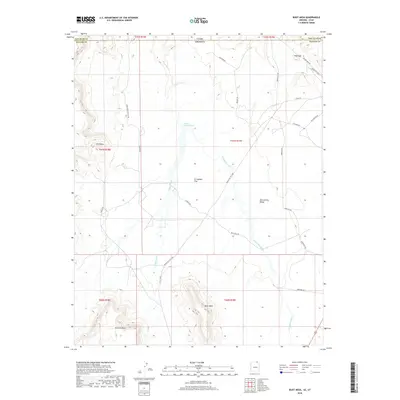
2018 Map of Boot Mesa
USGS Topo · Published 2018About this map
Monument Valley and the high desert terrain of the Arizona-Utah border define this high-resolution survey. The landscape is dominated by massive geological formations including Boot Mesa, Azansosi Mesa, and the distinctive Hat Rock near the northeastern boundary. Water drainage patterns are clearly visible through the sprawling Oljato Wash, Narrow Canyon Wash, and El Capitan Wash, which cut through the El Capitan Flat. The map reveals a network of local transport routes named for families and landmarks, such as Sullivan Rd, Yellowhair Rd, and Daniels Rd. These roads, alongside the Old Mine Rd, point to a history of land use centered around ranching, mining, and the unique topography of the Navajo Nation. Notable landmarks like The Ramp provide specific orientation points within this complex basin-and-range environment.
Find a feature on this map
33 named features on this map. Tap any name to fly to it.
Don’t see what you’re looking for? This feature index may not catch every label — zoom into the map to look around manually.
Map Details
Editions of this 2018 Boot Mesa Map
This is the sole edition of this map. No revisions or reprints were ever made.
Other maps of this area

1883 · Marsh Pass
USGS Topo · 1:250,000

1886 · Henry Mountains
USGS Topo · 1:250,000

1892 · Marsh Pass
USGS Topo · 1:250,000

1892 · Henry Mountains
USGS Topo · 1:250,000

1952 · Clay Hills 4 SW
USGS Topo · 1:24,000

1952 · Clay Hills 3 SE
USGS Topo · 1:24,000

1952 · Agathla Peak 1 NW
USGS Topo · 1:24,000

1952 · Agathla Peak 2 SW
USGS Topo · 1:24,000

1952 · Agathla Peak 2 NW
USGS Topo · 1:24,000

1952 · Boot Mesa
USGS Topo · 1:62,500