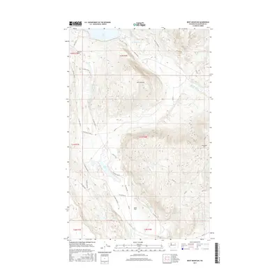
2017 Map of Boot Mountain
USGS Topo · Published 2017About this map
Boot Mountain dominates the central landscape of this Okanogan County region, surrounded by a complex network of canyons and high-plateau drainage systems. The northern reaches are defined by the shoreline of Omak Lake, while the interior terrain is marked by distinct geological features like Balance Rock and several isolated water bodies including Stinking Lake, Rat Lake, and Goose Lake. These intermittent and permanent lakes suggest the basin-and-range character typical of the area's geography.
Find a feature on this map
35 named features on this map. Tap any name to fly to it.
Don’t see what you’re looking for? This feature index may not catch every label — zoom into the map to look around manually.
Map Details
Editions of this 2017 Boot Mountain Map
This is the sole edition of this map. No revisions or reprints were ever made.
Other maps of this area

1950 · Boot Mtn
USGS Topo · 1:62,500

1950 · Alameda Flat
USGS Topo · 1:62,500

1952 · Alameda Flat
USGS Topo · 1:62,500

1952 · Disautel
USGS Topo · 1:62,500

1953 · Omak Lake
USGS Topo · 1:62,500

1954 · Okanogan
USGS Topo · 1:250,000

1958 · Okanogan
USGS Topo · 1:250,000
1980 · Camp Seven
USGS Topo · 1:24,000
1980 · Boot Mountain
USGS Topo · 1:24,000
1980 · Joe Lake
USGS Topo · 1:24,000