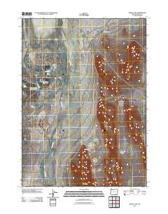
2011 Map of Borax Lake
USGS Topo · Published 2011About this map
Pueblo Valley serves as a stark desert landscape where geothermal activity and industrial history intersect. The northern reach of this survey is dominated by the seasonal waters of Alvord Lake, while the central area focuses on the thermal features of Hot Springs and the namesake Borax Lake. A specific point of historical interest is the Borax Works, marking where mineral extraction once defined local industry near the water. The drainage patterns are dictated by the seasonal flow of Trout Creek as it moves through the basin toward the playa. Evidence of water management in this arid environment appears at the Lower Borax Lake Reservoir, providing a clear look at how natural springs like Salt Springs and Buckbrush Spring were utilized or monitored in the early 21st century.
Find a feature on this map
11 named features on this map. Tap any name to fly to it.
Don’t see what you’re looking for? This feature index may not catch every label — zoom into the map to look around manually.
Map Details
Editions of this 2011 Borax Lake Map
This is the sole edition of this map. No revisions or reprints were ever made.
Other maps of this area

1955 · Adel
USGS Topo · 1:250,000

1957 · Adel
USGS Topo · 1:250,000

1958 · Adel
USGS Topo · 1:250,000

1962 · Adel
USGS Topo · 1:250,000

1971 · Andrews
USGS Topo · 1:24,000

1971 · V Lake
USGS Topo · 1:24,000

1971 · Fields
USGS Topo · 1:24,000

1971 · Borax Lake
USGS Topo · 1:24,000

1981 · Tule Springs
USGS Topo · 1:24,000
1981 · Tumtum Lake
USGS Topo · 1:24,000