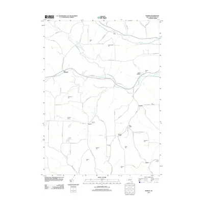
2012 Map of Borden
USGS Topo · Published 2012About this map
The Canisteo River valley dominates the northern reach of this Steuben County landscape, where the settlement at Derby Switch marks a historic point along the water and rail corridor. To the south, the terrain rises into a series of named heights including Hardscrabble Hill, Symonds Hill, and Tuscarora Hill. Small rural communities and farmsteads like Borden, Van Vleet, and Hillsprings Farm are connected by a network of winding roads such as Addison Back Rd and Symonds Hill Rd. Local history is preserved in several burial sites, including Elk Creek Cemetery and Swan Cemetery. The presence of the Elk Creek Airfield near Elk Creek suggests the continued importance of regional aviation in this agricultural and highland region of New York.
Find a feature on this map
70 named features on this map. Tap any name to fly to it.
Don’t see what you’re looking for? This feature index may not catch every label — zoom into the map to look around manually.
Map Details
Editions of this 2012 Borden Map
This is the sole edition of this map. No revisions or reprints were ever made.
Other maps of this area

1900 · Tioga
USGS Topo · 1:62,500

1900 · Elkland
USGS Topo · 1:62,500

1902 · Tioga
USGS Topo · 1:62,500

1914 · Corning
USGS Topo · 1:62,500

1924 · Woodhull
USGS Topo · 1:48,000

1926 · Woodhull
USGS Topo · 1:62,500

1944 · Woodhull
USGS Topo · 1:62,500

1944 · Corning
USGS Topo · 1:62,500

1950 · Elmira
USGS Topo · 1:250,000

1953 · Campbell
USGS Topo · 1:24,000