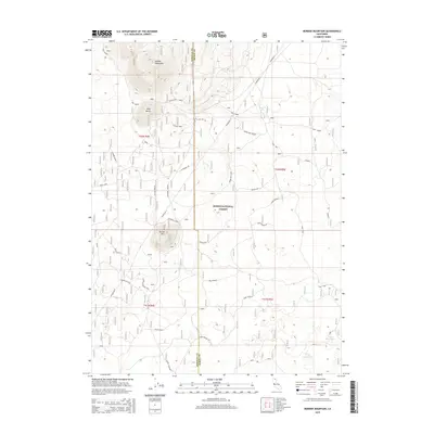
2015 Map of Border Mountain
USGS Topo · Published 2015About this map
Modoc National Forest dominates this volcanic landscape along the boundary of Siskiyou and Modoc counties, featuring a network of forest service roads and high-altitude terrain. The topography is defined by significant peaks such as Border Mountain, Buck Butte, and Round Mtn, which overlook a region managed for conservation and resources. The presence of Game Refuge 532 and various other areas marked simply as Game Refuge indicates the importance of wildlife management in this section of the Cascade Range. Water is a critical and sparse resource here, found at locations like Mud Spring, Deep Waterhole, and Frog Waterhole. A complex web of forest roads, including Black Mtn Bene, Snell Loop, and Long Bell, provides access through the timbered reaches and serves as a record of early 21st-century infrastructure in the high desert hinterlands.
Find a feature on this map
38 named features on this map. Tap any name to fly to it.
Don’t see what you’re looking for? This feature index may not catch every label — zoom into the map to look around manually.
Map Details
Editions of this 2015 Border Mountain Map
This is the sole edition of this map. No revisions or reprints were ever made.
Other maps of this area

1886 · Modoc Lava Bed
USGS Topo · 1:250,000

1892 · Modoc Lava-Bed
USGS Topo · 1:250,000

1932 · Bartle
USGS Topo · 1:96,000

1939 · Bartle
USGS Topo · 1:125,000

1952 · Timber Mountain
USGS Topo · 1:62,500

1952 · Medicine Lake
USGS Topo · 1:62,500

1954 · Alturas
USGS Topo · 1:250,000

1958 · Alturas
USGS Topo · 1:250,000

1961 · Hambone
USGS Topo · 1:62,500

1962 · Alturas
USGS Topo · 1:250,000