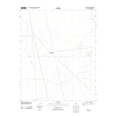
2012 Map of Boron NE
USGS Topo · Published 2012About this map
Fremont sits as a central point of reference in this arid stretch of the Mojave Desert within San Bernardino County. The landscape is defined by a dendritic network of seasonal washes and drainage patterns that characterize the high desert terrain. Grounded by the presence of Fremont Peak Rd, the map illustrates a sparse human footprint typical of this region's recent history. The geometric layout of local roads and sections suggests the methodical surveying of the area's open land, while the primary settlement area remains a focal point for those studying the distribution of outposts in the California desert during the early twenty-first century.
Find a feature on this map
2 named features on this map. Tap any name to fly to it.
Don’t see what you’re looking for? This feature index may not catch every label — zoom into the map to look around manually.
Map Details
Editions of this 2012 Boron NE Map
This is the sole edition of this map. No revisions or reprints were ever made.
Other maps of this area

1903 · Randsburg
USGS Topo · 1:62,500

1911 · Randsburg
USGS Topo · 1:62,500

1912 · Randsburg
USGS Topo · 1:62,500

1915 · Searles Lake
USGS Topo · 1:250,000

1947 · Johannesburg SE
USGS Topo · 1:25,000

1947 · Johannesburg SW
USGS Topo · 1:24,000

1947 · Trona
USGS Topo · 1:250,000

1948 · Trona
USGS Topo · 1:250,000

1953 · Trona
USGS Topo · 1:250,000
1954 · Boron
USGS Topo · 1:62,500