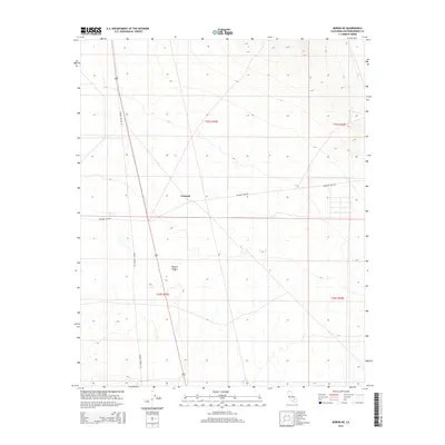
2015 Map of Boron NE
USGS Topo · Published 2015About this map
The high desert landscape of the western Mojave Desert defines this section of San Bernardino County, where the topography is characterized by vast, arid basins and gradual elevation shifts. The small settlement of Fremont sits at a critical junction in this remote terrain, serving as a landmark for travelers navigating the sparse network of desert tracks. Transportation through this section of the High Desert relies on long-established corridors such as Kramer Station Rd and Fremont Peak Rd, which provide essential access across the township and range lines. This 2015 data reflects the enduring character of the California desert, where modern surveying by the U.S. Geological Survey and Bureau of Land Management tracks a landscape that remains largely defined by its natural features and early infrastructure.
Find a feature on this map
8 named features on this map. Tap any name to fly to it.
Don’t see what you’re looking for? This feature index may not catch every label — zoom into the map to look around manually.
Map Details
Editions of this 2015 Boron NE Map
This is the sole edition of this map. No revisions or reprints were ever made.
Other maps of this area

1903 · Randsburg
USGS Topo · 1:62,500

1911 · Randsburg
USGS Topo · 1:62,500

1912 · Randsburg
USGS Topo · 1:62,500

1915 · Searles Lake
USGS Topo · 1:250,000

1947 · Johannesburg SE
USGS Topo · 1:25,000

1947 · Johannesburg SW
USGS Topo · 1:24,000

1947 · Trona
USGS Topo · 1:250,000

1948 · Trona
USGS Topo · 1:250,000

1953 · Trona
USGS Topo · 1:250,000
1954 · Boron
USGS Topo · 1:62,500