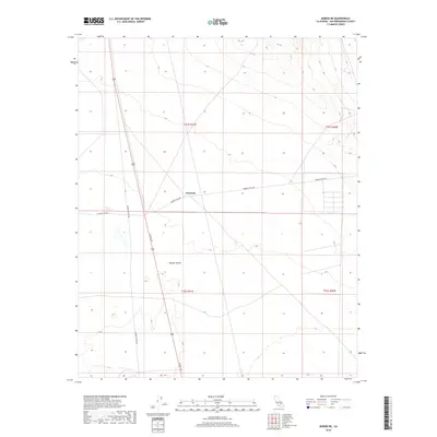
2018 Map of Boron NE
USGS Topo · Published 2018About this map
Mojave Desert terrain dominates this 2018 survey, centered on a critical intersection of infrastructure in the high desert. The primary north-south artery of US Rte 395 cuts through the landscape, flanked by the settlement of Fremont. This area illustrates the grid-based development of San Bernardino County, with prominent section lines and township boundaries like t32s r41e and t31s r42e defining the territory. The sparse network of desert tracks, including Fremont Peak Rd and Kramer Station Rd, provides a look at how accessibility and transit dictate the sparse settlement patterns in this arid region, where elevation contours reveal the subtle rises and falls of the desert floor.
Find a feature on this map
9 named features on this map. Tap any name to fly to it.
Don’t see what you’re looking for? This feature index may not catch every label — zoom into the map to look around manually.
Map Details
Editions of this 2018 Boron NE Map
This is the sole edition of this map. No revisions or reprints were ever made.
Other maps of this area

1903 · Randsburg
USGS Topo · 1:62,500

1911 · Randsburg
USGS Topo · 1:62,500

1912 · Randsburg
USGS Topo · 1:62,500

1915 · Searles Lake
USGS Topo · 1:250,000

1947 · Johannesburg SE
USGS Topo · 1:25,000

1947 · Johannesburg SW
USGS Topo · 1:24,000

1947 · Trona
USGS Topo · 1:250,000

1948 · Trona
USGS Topo · 1:250,000

1953 · Trona
USGS Topo · 1:250,000
1954 · Boron
USGS Topo · 1:62,500