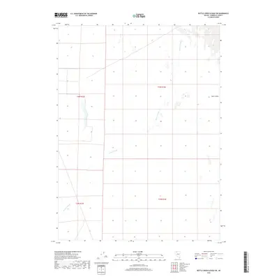
2018 Map of Bottle Creek Slough SW
USGS Topo · Published 2018About this map
Desert Valley dominates this arid landscape in Humboldt County, where the intricate drainage patterns of the Bottle Creek Slough wind across the basin. This 2018 survey illustrates the vast, unpopulated character of the High Desert during the early 21st century, defined largely by its Public Land Survey System grids rather than urban infrastructure. The map documents the essential hydrology of the region, showing how the ephemeral Bottle Creek Slough meanders through the valley floor, providing a critical reference for understanding water movement in this remote part of Nevada. Historical boundaries, including the townships of t40n r34e, t40n r33e, and t39n r34e, provide the primary structural framework for the terrain, reflecting the long-standing rectangular survey system used to manage these expansive public lands.
Find a feature on this map
6 named features on this map. Tap any name to fly to it.
Don’t see what you’re looking for? This feature index may not catch every label — zoom into the map to look around manually.
Map Details
Editions of this 2018 Bottle Creek Slough SW Map
This is the sole edition of this map. No revisions or reprints were ever made.
Other maps of this area

1886 · Disaster
USGS Topo · 1:250,000

1893 · Disaster
USGS Topo · 1:250,000

1954 · Vya
USGS Topo · 1:250,000

1958 · Vya
USGS Topo · 1:250,000

1961 · Bottle Creek
USGS Topo · 1:62,500

1962 · Vya
USGS Topo · 1:250,000

1966 · Donna Schee Peak
USGS Topo · 1:62,500
1982 · Bottle Creek Slough SW
USGS Topo · 1:24,000
1982 · Sombrero Peak
USGS Topo · 1:24,000
1982 · Presnel Well
USGS Topo · 1:24,000