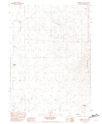
1982 Map of Sombrero Peak
USGS Topo · Published 1982About this map
Sombrero Peak serves as a prominent landmark in this desert landscape of Humboldt County, marking the southern edge of the Slumbering Hills. The map details a region defined by arid basins and isolated peaks, where water sources like Crescent Well, Gabica Well, and Corbeal Well were vital to the livestock operations and mining ventures of the era. To the north, the Pickhandle Mine indicates the ongoing search for mineral wealth that drove much of the interior West's development. Large tracts of Sand Dunes dominate the southwestern portion of the quadrangle, illustrating the shifting, wind-carved terrain of the Nevada desert. Topographic variations between Gabica Butte and Corbeal Butte provide a clear view of the complex geomorphology that characterizes this remote part of the Great Basin.
Find a feature on this map
11 named features on this map. Tap any name to fly to it.
Don’t see what you’re looking for? This feature index may not catch every label — zoom into the map to look around manually.
Map Details
Editions of this 1982 Sombrero Peak Map
This is the sole edition of this map. No revisions or reprints were ever made.
Other maps of this area

1882 · Paradise
USGS Topo · 1:250,000

1886 · Disaster
USGS Topo · 1:250,000

1893 · Paradise
USGS Topo · 1:250,000

1893 · Disaster
USGS Topo · 1:250,000

1954 · Vya
USGS Topo · 1:250,000

1955 · McDermitt
USGS Topo · 1:250,000

1958 · Vya
USGS Topo · 1:250,000

1958 · Awakening Peak
USGS Topo · 1:62,500

1959 · McDermitt
USGS Topo · 1:250,000

1962 · Vya
USGS Topo · 1:250,000