
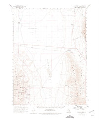
1958 Map of Awakening Peak
USGS Topo · Published 1960About this map
The Awakening Mining District defines the character of the Slumbering Hills on this late-1950s survey of Humboldt County. The landscape is punctuated by numerous mining claims, including the Humboldt Mine, Jumbo Mine, Alabama Mine, and Spanish Girl Mine, many of which are situated near Daveytown and the historic location of Awakening. These operations represent the era's continued pursuit of mineral wealth in the high desert of Nevada.
Find a feature on this map
40 named features on this map. Tap any name to fly to it.
Don’t see what you’re looking for? This feature index may not catch every label — zoom into the map to look around manually.
Map Details
Editions of this 1958 Awakening Peak Map
2 editions found
Other maps of this area

1882 · Paradise
USGS Topo · 1:250,000

1886 · Disaster
USGS Topo · 1:250,000

1893 · Paradise
USGS Topo · 1:250,000

1893 · Disaster
USGS Topo · 1:250,000

1954 · Vya
USGS Topo · 1:250,000

1955 · McDermitt
USGS Topo · 1:250,000

1958 · Vya
USGS Topo · 1:250,000

1958 · Paradise Valley
USGS Topo · 1:62,500

1959 · McDermitt
USGS Topo · 1:250,000

1959 · Bliss
USGS Topo · 1:62,500