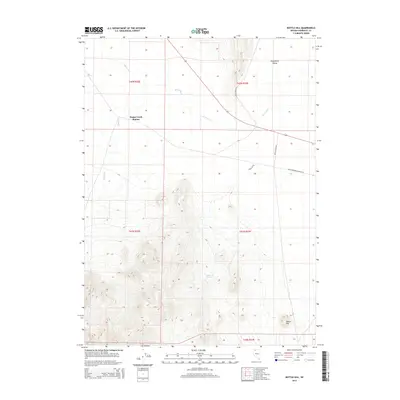
2015 Map of Bottle Hill
USGS Topo · Published 2015About this map
Happy Creek Station serves as a lone outpost in the northern reaches of the Kings River Valley, where the ephemeral Quinn River cuts through the high desert of Humboldt County. The terrain transitions from the broad, flat river basin to the rising elevations of the Slumbering Hills, anchored by the namesake summit of Bottle Hill. Water remains the defining constraint of this landscape, marked by isolated points like Buckbrush Spring and the seasonal flow of Happy Cr. Transportation in this modern era follows long-established desert routes, including the Old Winnemucca-Denio Rd and Bottle Creek Rd, which trace the paths of least resistance between the rugged uplands and the alluvial plains. This landscape reflects the sparse, ranch-oriented settlement patterns characteristic of the Great Basin's interior.
Find a feature on this map
15 named features on this map. Tap any name to fly to it.
Don’t see what you’re looking for? This feature index may not catch every label — zoom into the map to look around manually.
Map Details
Editions of this 2015 Bottle Hill Map
This is the sole edition of this map. No revisions or reprints were ever made.
Other maps of this area

1886 · Disaster
USGS Topo · 1:250,000

1893 · Disaster
USGS Topo · 1:250,000

1954 · Vya
USGS Topo · 1:250,000

1958 · Vya
USGS Topo · 1:250,000

1961 · Quinn River Crossing
USGS Topo · 1:62,500

1961 · Thacker Pass
USGS Topo · 1:62,500

1961 · Bottle Creek
USGS Topo · 1:62,500

1962 · Vya
USGS Topo · 1:250,000

1979 · Denio
USGS Topo · 1:100,000
1982 · Bottle Creek Slough SW
USGS Topo · 1:24,000