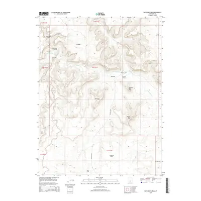
2014 Map of Bottleneck Peak
USGS Topo · Published 2014About this map
Bottleneck Peak and the high desert plateaus of the San Rafael Swell define this 2014 landscape, where the deeply incised San Rafael River carves through the earth. The topographic detail highlights the dramatic relief of the Little Grand Canyon and the prominent southern formations of Window Blind Peak and Assembly Hall Peak. This area, managed largely for its significant natural features, includes the The Wedge Overlook, providing a perspective over the vast drainage systems of Good Water Canyon and Buckhorn Wash. Human activity is concentrated along the river corridor at the San Rafael Bridge Campground and follows the winding path of Buckhorn Draw Rd. In the southern reaches of the quadrangle, the presence of Oil Well Draw and the broad Limestone Bench suggests the localized industrial and grazing uses that coexist with the protected backcountry and its notable landmarks like No Mans Mtn.
Find a feature on this map
26 named features on this map. Tap any name to fly to it.
Don’t see what you’re looking for? This feature index may not catch every label — zoom into the map to look around manually.
Map Details
Editions of this 2014 Bottleneck Peak Map
This is the sole edition of this map. No revisions or reprints were ever made.
Other maps of this area

1885 · San Rafael
USGS Topo · 1:250,000

1886 · Price River
USGS Topo · 1:250,000

1896 · Price River
USGS Topo · 1:250,000

1952 · San Rafael Knob
USGS Topo · 1:62,500

1953 · Wilsonville SE
USGS Topo · 1:24,000

1953 · Red Plateau SE
USGS Topo · 1:24,000

1953 · Red Plateau SW
USGS Topo · 1:24,000

1954 · Stinking Spring Creek 1 NW
USGS Topo · 1:24,000

1954 · Stinking Spring Creek 1 NE
USGS Topo · 1:24,000

1954 · Stinking Spring Creek 2 NE
USGS Topo · 1:24,000