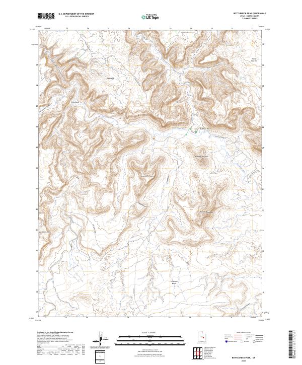
2023 Map of Bottleneck Peak
USGS Topo · Published 2023About this map
The San Rafael River carves a winding path through this corner of Emery County, Utah, where deep incisions in the earth reveal landforms like the Little Grand Canyon and Good Water Canyon. Rising sharply from the surrounding landscape are prominent geological landmarks such as Bottleneck Peak, Assembly Hall Peak, and Window Blind Peak. This geography is defined by its sheer mesas and drainage systems, including the high Calf Mesa and the lower Limestone Bench. Access into these corridors is documented by routes such as Lower Wedge Rd and San Rafael River Rd. The presence of Calf Mesa Spr and named features like Oil Well Draw indicate the critical role of water sources and resource exploration in this arid reach of the San Rafael Swell.
Find a feature on this map
23 named features on this map. Tap any name to fly to it.
Don’t see what you’re looking for? This feature index may not catch every label — zoom into the map to look around manually.
Map Details
Editions of this 2023 Bottleneck Peak Map
This is the sole edition of this map. No revisions or reprints were ever made.
Other maps of this area

1885 · San Rafael
USGS Topo · 1:250,000

1886 · Price River
USGS Topo · 1:250,000

1896 · Price River
USGS Topo · 1:250,000

1952 · San Rafael Knob
USGS Topo · 1:62,500

1953 · Wilsonville SE
USGS Topo · 1:24,000

1953 · Red Plateau SE
USGS Topo · 1:24,000

1953 · Red Plateau SW
USGS Topo · 1:24,000

1954 · Stinking Spring Creek 1 NW
USGS Topo · 1:24,000

1954 · Stinking Spring Creek 1 NE
USGS Topo · 1:24,000

1954 · Stinking Spring Creek 2 NE
USGS Topo · 1:24,000