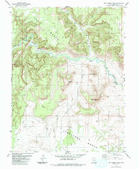
1983 Map of Bottleneck Peak
USGS Topo · Published 1983About this map
San Rafael River carves a deep, winding course through this central Utah landscape, defining the transition between the plateau of The Wedge and the southern Limestone Bench. The river's path through the Little Grand Canyon is marked by sharp elevation changes and significant erosion, creating prominent landmarks like Bottleneck Peak and Assembly Hall Peak. This 1983 edition captures the remote character of the area, where water is the primary architect of the terrain, seen in the numerous labels for a spring and the confluence at Buckhorn Wash.
Find a feature on this map
28 named features on this map. Tap any name to fly to it.
Don’t see what you’re looking for? This feature index may not catch every label — zoom into the map to look around manually.
Map Details
Editions of this 1983 Bottleneck Peak Map
This is the sole edition of this map. No revisions or reprints were ever made.
Other maps of this area

1885 · San Rafael
USGS Topo · 1:250,000

1886 · Price River
USGS Topo · 1:250,000

1896 · Price River
USGS Topo · 1:250,000

1952 · San Rafael Knob
USGS Topo · 1:62,500

1953 · Wilsonville SE
USGS Topo · 1:24,000

1953 · Red Plateau SE
USGS Topo · 1:24,000

1953 · Red Plateau SW
USGS Topo · 1:24,000

1954 · Stinking Spring Creek 1 NW
USGS Topo · 1:24,000

1954 · Stinking Spring Creek 1 NE
USGS Topo · 1:24,000

1954 · Stinking Spring Creek 2 NE
USGS Topo · 1:24,000