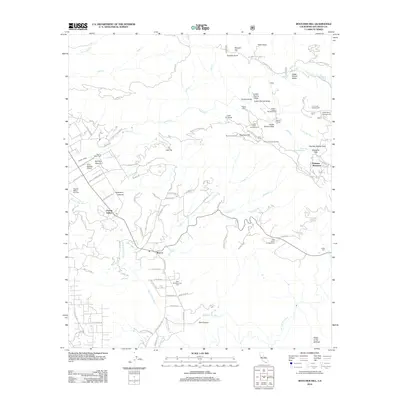
2012 Map of Boucher Hill
USGS Topo · Published 2012About this map
The San Luis Rey River winds through this section of San Diego County, anchoring a landscape where agricultural ranching meets the steep slopes of the coastal range. Local history is centered around the settlements of Pauma Valley and Rincon, where the distribution of Saint Bartholomew Cem and the Pauma Valley Cem reflects long-standing community roots. The topography rises sharply toward Palomar Mountain, featuring landmarks like the Boucher Lookout and the Boucher Hill summit. The area’s geography is defined by numerous drainage systems, including Pauma Cr and Yuima Cr, which feed the valley floor from the surrounding heights. Recreational and ranching sites are scattered throughout the higher elevations, including the Doane Valley Campground and Webber Ranch, illustrating the transition from the fertile valley floor to the protected upland forests.
Find a feature on this map
98 named features on this map. Tap any name to fly to it.
Don’t see what you’re looking for? This feature index may not catch every label — zoom into the map to look around manually.
Map Details
Editions of this 2012 Boucher Hill Map
This is the sole edition of this map. No revisions or reprints were ever made.
Other maps of this area

1893 · Escondido
USGS Topo · 1:62,500

1901 · Escondido
USGS Topo · 1:62,500

1901 · San Luis Rey
USGS Topo · 1:125,000

1903 · Ramona
USGS Topo · 1:125,000

1904 · Southern California Sheet No. 2
USGS Topo · 1:250,000

1939 · Palomar Mountain
USGS Topo · 1:62,500

1942 · Temecula
USGS Topo · 1:62,500

1942 · Escondido
USGS Topo · 1:62,500

1942 · Ramona
USGS Topo · 1:62,500

1947 · Ramona
USGS Topo · 1:62,500