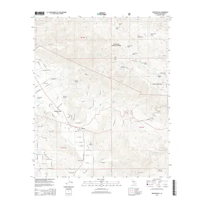
2015 Map of Boucher Hill
USGS Topo · Published 2015About this map
The San Luis Rey River winds through this region of the California coastal range, where the steep slopes of Palomar Mountain and Boucher Hill overlook the flat agricultural lands of Pauma Valley. The landscape is defined by the transition from the protected woodlands of the Cleveland National Forest to the developed valley floor, where modern infrastructure like the Escondido Canal and Highway 76 support local commerce and transit. Significant genealogical sites are documented here, including the Pauma Valley Cemetery and the Saint Bartholomew Cemetery near Rincon. Aviation history is present via the Lyall Airport and the Pauma Valley Air Park, while the high country features distinct topographical markers such as Sunday School Flats and the Doane Valley Reservoir.
Find a feature on this map
98 named features on this map. Tap any name to fly to it.
Don’t see what you’re looking for? This feature index may not catch every label — zoom into the map to look around manually.
Map Details
Editions of this 2015 Boucher Hill Map
This is the sole edition of this map. No revisions or reprints were ever made.
Other maps of this area

1893 · Escondido
USGS Topo · 1:62,500

1901 · Escondido
USGS Topo · 1:62,500

1901 · San Luis Rey
USGS Topo · 1:125,000

1903 · Ramona
USGS Topo · 1:125,000

1904 · Southern California Sheet No. 2
USGS Topo · 1:250,000

1939 · Palomar Mountain
USGS Topo · 1:62,500

1942 · Temecula
USGS Topo · 1:62,500

1942 · Escondido
USGS Topo · 1:62,500

1942 · Ramona
USGS Topo · 1:62,500

1947 · Ramona
USGS Topo · 1:62,500