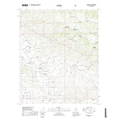
2018 Map of Boucher Hill
USGS Topo · Published 2018About this map
Pauma Valley and the Rincon community are central to this 2018 survey of northern San Diego County, situated along the San Luis Rey River. The landscape is dominated by the steep western slopes of Palomar Mountain, much of which is protected within the Cleveland National Forest. This terrain includes distinctive landmarks like Boucher Hill and several high-altitude meadows such as Tin Can Flat and Sunday School Flats. The presence of the Saint Bartholomew Cem and Saint Francis Episcopal Church Memorial Garden provides specific points of interest for genealogists tracing local families in the valley. Meanwhile, the complex water management of the region is evidenced by the Escondido Canal, which winds through the foothills, and recreation-focused water bodies like Doane Pond and the Doane Valley Reservoir located at higher elevations. The infrastructure of the valley floor is further characterized by local aviation sites, including the Pauma Valley Air Park and Lyall Airport.
Find a feature on this map
122 named features on this map. Tap any name to fly to it.
Don’t see what you’re looking for? This feature index may not catch every label — zoom into the map to look around manually.
Map Details
Editions of this 2018 Boucher Hill Map
This is the sole edition of this map. No revisions or reprints were ever made.
Other maps of this area

1893 · Escondido
USGS Topo · 1:62,500

1901 · Escondido
USGS Topo · 1:62,500

1901 · San Luis Rey
USGS Topo · 1:125,000

1903 · Ramona
USGS Topo · 1:125,000

1904 · Southern California Sheet No. 2
USGS Topo · 1:250,000

1939 · Palomar Mountain
USGS Topo · 1:62,500

1942 · Temecula
USGS Topo · 1:62,500

1942 · Escondido
USGS Topo · 1:62,500

1942 · Ramona
USGS Topo · 1:62,500

1947 · Ramona
USGS Topo · 1:62,500