
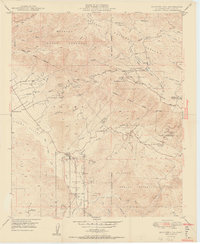
1950 Map of Boucher Hill
USGS Topo · Published 1950About this map
Mission Indian Reserve and several neighboring tribal lands dominate this mountainous reach of the Cleveland National Forest in the mid-century. The landscape is a complex network of canyons and peaks, including Boucher Hill and Palomar Mountain, where the Palomar Mountain (PO) and Sunday School Flats provide isolated hubs of activity. The lower elevations are defined by the San Luis Rey River and the Escondido Canal, which supported the early hydraulic and agricultural development of the region.
Find a feature on this map
57 named features on this map. Tap any name to fly to it.
Don’t see what you’re looking for? This feature index may not catch every label — zoom into the map to look around manually.
Map Details
Editions of this 1950 Boucher Hill Map
2 editions found
Other maps of this area

1893 · Escondido
USGS Topo · 1:62,500

1901 · Escondido
USGS Topo · 1:62,500

1901 · San Luis Rey
USGS Topo · 1:125,000

1903 · Ramona
USGS Topo · 1:125,000

1904 · Southern California Sheet No. 2
USGS Topo · 1:250,000

1939 · Palomar Mountain
USGS Topo · 1:62,500

1942 · Temecula
USGS Topo · 1:62,500

1942 · Escondido
USGS Topo · 1:62,500

1942 · Ramona
USGS Topo · 1:62,500

1947 · Ramona
USGS Topo · 1:62,500