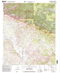
1997 Map of Boucher Hill
USGS Topo · Published 2000About this map
Palomar Mountain State Park and the world-renowned Palomar Observatory dominate the high ridges of this late-20th-century topographic study. The landscape is defined by its deep cultural heritage and complex land tenure, featuring the Rincon Indian Reservation, Pala Indian Reservation, and Yuima I R nestled between the steep slopes of Boucher Hill and the San Luis Rey River. Evidence of early 20th-century social history appears at the Happyland Sanitorium and the Pauma Valley Country Club, reflecting the diverse uses of the valley floor.
Find a feature on this map
55 named features on this map. Tap any name to fly to it.
Don’t see what you’re looking for? This feature index may not catch every label — zoom into the map to look around manually.
Map Details
Editions of this 1997 Boucher Hill Map
This is the sole edition of this map. No revisions or reprints were ever made.
Other maps of this area

1893 · Escondido
USGS Topo · 1:62,500

1901 · Escondido
USGS Topo · 1:62,500

1901 · San Luis Rey
USGS Topo · 1:125,000

1903 · Ramona
USGS Topo · 1:125,000

1904 · Southern California Sheet No. 2
USGS Topo · 1:250,000

1939 · Palomar Mountain
USGS Topo · 1:62,500

1942 · Temecula
USGS Topo · 1:62,500

1942 · Escondido
USGS Topo · 1:62,500

1942 · Ramona
USGS Topo · 1:62,500

1947 · Ramona
USGS Topo · 1:62,500