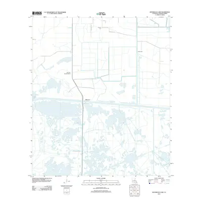
2012 Map of Boudreaux Lake
USGS Topo · Published 2012About this map
Gibbstown serves as a focal point in this coastal marsh landscape, where human engineering meets the tidal waters of Calcasieu. The terrain is defined by a network of drainage and industrial infrastructure, including the North Canal and roads like Conoco Plant Rd that reflect the region's energy and maritime economy. Near the northern boundary, the Granger Cem stands along Betty Murles Rd, offering a point of genealogical interest for those tracing local family histories in Cameron Parish. The geography transitions from the open waters of Sweet Lake to the uniquely named Savanne Neuville Island, showcasing the complex coastal prairies and wetlands characteristic of Southwest Louisiana. Local transit is marked by paths such as Old Ferry Rd and Grangerville Rd, which suggest older patterns of movement before modern highway improvements.
Find a feature on this map
14 named features on this map. Tap any name to fly to it.
Don’t see what you’re looking for? This feature index may not catch every label — zoom into the map to look around manually.
Map Details
Editions of this 2012 Boudreaux Lake Map
This is the sole edition of this map. No revisions or reprints were ever made.
Other maps of this area

1932 · Lake Charles SW
USGS Topo · 1:31,680

1932 · Lake Charles SE
USGS Topo · 1:31,680

1934 · Lake Misere
USGS Topo · 1:24,000

1934 · Sweet Lake
USGS Topo · 1:24,000

1934 · Grand Bayou
USGS Topo · 1:24,000

1934 · Boudreaux Lake
USGS Topo · 1:24,000

1935 · Sweet Lake
USGS Topo · 1:31,680

1935 · Lake Misere
USGS Topo · 1:31,680

1935 · Boudreaux Lake
USGS Topo · 1:31,680

1935 · Grand Bayou
USGS Topo · 1:31,680