
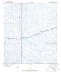
1934 Map of Lake Misere
USGS Topo · Published 1955About this map
Low-lying wetlands and intricate waterways dominate this coastal Cameron Parish landscape as it was surveyed in the 1930s. The Lake Misere basin is the central feature, connected via The Narrows to Little Lake Misere. This aquatic environment is transected by the industrial route of the Intracoastal Waterway, which cuts a straight line through the marshlands toward the settlement of Cady.
Find a feature on this map
12 named features on this map. Tap any name to fly to it.
Don’t see what you’re looking for? This feature index may not catch every label — zoom into the map to look around manually.
Map Details
Editions of this 1934 Lake Misere Map
2 editions found
Other maps of this area

1932 · Lake Charles SE
USGS Topo · 1:31,680

1934 · Catfish Lake
USGS Topo · 1:24,000

1934 · Boudreaux Lake
USGS Topo · 1:24,000

1934 · Latania Lake
USGS Topo · 1:24,000

1935 · Lake Misere
USGS Topo · 1:31,680

1935 · Catfish Lake
USGS Topo · 1:31,680

1935 · Latania Lake
USGS Topo · 1:31,680

1935 · Boudreaux Lake
USGS Topo · 1:31,680

1935 · Bay Labauve
USGS Topo · 1:31,680

1935 · Grand Chenier
USGS Topo · 1:31,680