
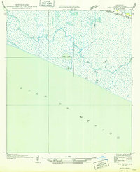
1935 Map of Catfish Lake
USGS Topo · Published 1935About this map
Catfish Lake and the surrounding marshlands of Grand Lake define this coastal landscape, surveyed in 1934 during a period of transition in Louisiana's hydraulic mapping. The use of aerial photography by the Air Corps, U. S. Army, allowed for the detailed tracing of intricate waterways like Little Pecan Bayou and Go Around Bayou. These natural drainages are contrasted by early man-made infrastructure such as the Miller Canal and the settlements along Hackberry Ridge. On Pecan Island, a labeled Boat Landing indicates the water-dependent transportation network of the era. The terrain is marked by distinct cheniers including Chenier and Elm Island, providing essential high ground amidst the expansive wetlands of the Mermentau River delta. Local landmarks such as Tebo Point and Betty offer specific points of interest for genealogists and local historians studying the early 20th-century coastal economy.
Find a feature on this map
24 named features on this map. Tap any name to fly to it.
Don’t see what you’re looking for? This feature index may not catch every label — zoom into the map to look around manually.
Map Details
Editions of this 1935 Catfish Lake Map
This is the sole edition of this map. No revisions or reprints were ever made.
Other maps of this area

1932 · Constance Bayou NW
USGS Topo · 1:31,680

1934 · Catfish Lake
USGS Topo · 1:24,000

1934 · Lake Misere
USGS Topo · 1:24,000

1934 · Latania Lake
USGS Topo · 1:24,000

1935 · Lake Misere
USGS Topo · 1:31,680

1935 · Latania Lake
USGS Topo · 1:31,680

1935 · Grand Chenier
USGS Topo · 1:31,680

1946 · Hog Bayou NE
USGS Topo · 1:31,680

1946 · Hog Bayou NW
USGS Topo · 1:31,680
1949 · Hog Bayou NW
USGS Topo · 1:31,680