
1946 Map of Hog Bayou NW
USGS Topo · Published 1946About this map
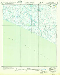
Grand Cheniere Ridge defines the northern reaches of this coastal landscape, providing the only significant elevated ground above the expansive marshlands of Cameron Parish. Established during a period of collaborative surveying by the U.S. Geological Survey and the State of Louisiana, this map captures the intricate drainage patterns of the Hog Bayou system as it meanders toward the Gulf of Mexico. Local hydrology is dominated by small, isolated water bodies like Crab Lake and Beach Pond, while the transit infrastructure is confined to the ridge line along State Highway No. 292. The survey reflects a sparsely populated environment where the natural movement of water across tidal flats and through channels like First Lake dictates the geography, long before modern coastal management altered these wetlands.
Find a feature on this map
11 named features on this map. Tap any name to fly to it.
Don’t see what you’re looking for? This feature index may not catch every label — zoom into the map to look around manually.
Map Details
Editions of this 1946 Hog Bayou NW Map
This is the sole edition of this map. No revisions or reprints were ever made.
Other maps of this area

1934 · Catfish Lake
USGS Topo · 1:24,000

1935 · Catfish Lake
USGS Topo · 1:31,680

1935 · Bay Labauve
USGS Topo · 1:31,680

1935 · Grand Chenier
USGS Topo · 1:31,680

1946 · Hog Bayou NE
USGS Topo · 1:31,680
1949 · Hog Bayou NW
USGS Topo · 1:31,680

1949 · Hog Bayou NE
USGS Topo · 1:31,680

1954 · Port Arthur
USGS Topo · 1:250,000
1955 · Sweet Lake
USGS Topo · 1:62,500
1955 · Hog Bayou
USGS Topo · 1:62,500