
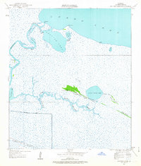
1934 Map of Catfish Lake
USGS Topo · Published 1955About this map
Catfish Lake and the complex wetlands of Grand Lake define this coastal Louisiana landscape, where the tides and bayous dictated human movement in the mid-1930s. Small outposts like Catfish and Betty sit along the northern shore, while the interior is accessible only by water via the Mermentau River and winding channels like Cut Around Bayou. The existence of a Pirogue Trail south of Little Pecan Lake highlights the traditional Acadian and Cajun reliance on shallow-draft boats to navigate the marshy interior between Lake Islands and Long Island.
Find a feature on this map
26 named features on this map. Tap any name to fly to it.
Don’t see what you’re looking for? This feature index may not catch every label — zoom into the map to look around manually.
Map Details
Editions of this 1934 Catfish Lake Map
2 editions found
Other maps of this area

1932 · Constance Bayou NW
USGS Topo · 1:31,680

1934 · Lake Misere
USGS Topo · 1:24,000

1934 · Latania Lake
USGS Topo · 1:24,000

1935 · Lake Misere
USGS Topo · 1:31,680

1935 · Catfish Lake
USGS Topo · 1:31,680

1935 · Latania Lake
USGS Topo · 1:31,680

1935 · Grand Chenier
USGS Topo · 1:31,680

1946 · Hog Bayou NE
USGS Topo · 1:31,680

1946 · Hog Bayou NW
USGS Topo · 1:31,680
1949 · Hog Bayou NW
USGS Topo · 1:31,680