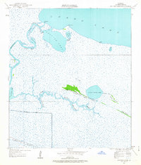
1934 Map of Catfish Lake
USGS Topo · Published 1963About this map
Grand Lake and the intricate marshlands of Cameron Parish dominate this mid-1930s survey, revealing a landscape defined by water and narrow ridges of high ground. Small coastal outposts like Catfish and Betty sit along the northern shores, while further south, Little Pecan Island provides a corridor for human movement through the wetlands. A Pirogue Trail cuts through the marsh east of Little Pecan Lake, illustrating how residents navigated this environment using traditional watercraft.
Find a feature on this map
24 named features on this map. Tap any name to fly to it.
Don’t see what you’re looking for? This feature index may not catch every label — zoom into the map to look around manually.
Map Details
Editions of this 1934 Catfish Lake Map
2 editions found
Other maps of this area

1932 · Constance Bayou NW
USGS Topo · 1:31,680

1934 · Catfish Lake
USGS Topo · 1:24,000

1934 · Lake Misere
USGS Topo · 1:24,000

1934 · Latania Lake
USGS Topo · 1:24,000

1935 · Lake Misere
USGS Topo · 1:31,680

1935 · Catfish Lake
USGS Topo · 1:31,680

1935 · Latania Lake
USGS Topo · 1:31,680

1935 · Grand Chenier
USGS Topo · 1:31,680

1946 · Hog Bayou NE
USGS Topo · 1:31,680

1946 · Hog Bayou NW
USGS Topo · 1:31,680