
Loading...
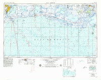
Loading map...1954 Map of Port Arthur
USGS Topo · Published 1954About this map
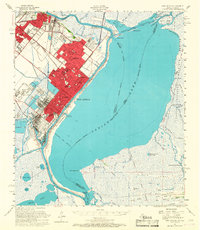
The coastal wetlands and industrial centers of the Texas-Louisiana border emerge in detail across this 1954 survey. Port Arthur stands as the primary urban anchor, situated at the confluence of the Neches River and the expansive Sabine Lake. The landscape to the east is dominated by vast marshlands and migratory waterfowl refuges, including the Sabine Lake Migratory Waterfowl Refuge and the Rockefeller Wild Life Refuge and Game Preserve.
Find a feature on this map
165 named features on this map. Tap any name to fly to it.
Don’t see what you’re looking for? This feature index may not catch every label — zoom into the map to look around manually.
Map Details
Date Portrayed1954
Date Published1954
PublisherU.S. Geological Survey
Map TypeTopographic
Scale1:250,000
Physical Dimensions34 x 24.1 inches
Editions of this 1954 Port Arthur Map
This is the sole edition of this map. No revisions or reprints were ever made.
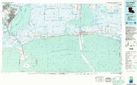
Historical Maps of Port Arthur Through Time
7 maps found


Featured Locations
Source Details
SourceU.S. Geological Survey
CopyrightPublic Domain