
1932 Map of Sabine Pass NE
USGS Topo · Published 1932About this map
Sabine Pass serves as the critical maritime artery in this early 1930s survey, marking the jurisdictional boundary between Louisiana and Texas. The map highlights the engineered navigable channel, flanked by the prominent East Jetty and West Jetty that extend deep into the Gulf of Mexico. Along the western shoreline, the Southern Pacific railroad corridor runs parallel to the water, terminating near the coastal marshlands. This era captures the shoreline before significant modern erosion, detailing natural coastal features like Louisiana Point and the winding Lighthouse Bayou. A notable historical landmark is the Lighthouse positioned near the jetties, while the East Bdy Old Military Reservation line provides a glimpse into the region's earlier strategic land use and federal presence at the mouth of the Sabine River.
Find a feature on this map
13 named features on this map. Tap any name to fly to it.
Don’t see what you’re looking for? This feature index may not catch every label — zoom into the map to look around manually.
Map Details
Editions of this 1932 Sabine Pass NE Map
This is the sole edition of this map. No revisions or reprints were ever made.
Other maps of this area

1934 · Johnsons Bayou
USGS Topo · 1:24,000

1935 · Johnsons Bayou
USGS Topo · 1:31,680

1943 · West of Johnson Bayou
USGS Topo · 1:24,000

1943 · Port Arthur South
USGS Topo · 1:24,000

1944 · Sabine Pass
USGS Topo · 1:31,680

1944 · Texas Point
USGS Topo · 1:31,680
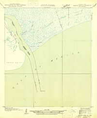
1946 · Sabine Pass NE
USGS Topo · 1:31,680
1946 · Port Arthur SE
USGS Topo · 1:31,680

1954 · Port Arthur
USGS Topo · 1:250,000
1955 · Johnsons Bayou
USGS Topo · 1:62,500