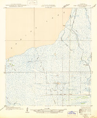
1946 Map of Port Arthur SE
USGS Topo · Published 1946About this map
Sabine Lake defines the western edge of this coastal landscape, where the marshy terrain of Cameron Parish meets the water. The settlement of Johnson Bayou and its accompanying Johnson Bayou Landing serve as the primary human anchors in a region dominated by intricate waterways and low-lying ridges. These elevated features, including Garrison Ridge, Buck Ridge, and Blue Buck Ridge, provide the only significant relief in an area otherwise characterized by extensive wetlands.
Find a feature on this map
17 named features on this map. Tap any name to fly to it.
Don’t see what you’re looking for? This feature index may not catch every label — zoom into the map to look around manually.
Map Details
Editions of this 1946 Port Arthur SE Map
This is the sole edition of this map. No revisions or reprints were ever made.
Other maps of this area

1932 · Sabine Pass NE
USGS Topo · 1:31,680

1932 · Port Arthur NE
USGS Topo · 1:31,680

1934 · Johnsons Bayou
USGS Topo · 1:24,000

1934 · Greens Bayou
USGS Topo · 1:24,000

1935 · Greens Bayou
USGS Topo · 1:31,680

1935 · Johnsons Bayou
USGS Topo · 1:31,680

1943 · West of Johnson Bayou
USGS Topo · 1:24,000

1943 · West of Greens Bayou
USGS Topo · 1:24,000

1943 · Port Arthur North
USGS Topo · 1:24,000

1943 · Port Arthur South
USGS Topo · 1:24,000