
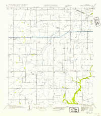
1932 Map of Abbeville NE
USGS Topo · Published 1932About this map
Vermilion Bayou snakes through this coastal Louisiana landscape, defining the western edge of a region heavily shaped by early 20th-century water management and rail commerce. The Southern Pacific railroad serves as the primary east-west spine, connecting the bustling center of Abbeville to the established town of Erath. Smaller rural clusters such as Grosse Isle, Aristide, and Mack sit along the tracks, reflecting a settlement pattern driven by sugar and rice production.
Find a feature on this map
27 named features on this map. Tap any name to fly to it.
Don’t see what you’re looking for? This feature index may not catch every label — zoom into the map to look around manually.
Map Details
Editions of this 1932 Abbeville NE Map
This is the sole edition of this map. No revisions or reprints were ever made.
Other maps of this area

1932 · Abbeville SW
USGS Topo · 1:31,680

1932 · Abbeville SE
USGS Topo · 1:31,680

1932 · Abbeville NW
USGS Topo · 1:31,680

1937 · Derouen
USGS Topo · 1:62,500

1939 · St. Martinsville
USGS Topo · 1:62,500

1945 · New Orleans
USGS Topo · 1:250,000

1946 · Milton
USGS Topo · 1:31,680

1946 · Leroy
USGS Topo · 1:31,680

1952 · Lake Charles
USGS Topo · 1:250,000
1954 · Leroy
USGS Topo · 1:31,680