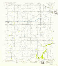
1954 Map of Leroy
USGS Topo · Published 1954About this map
The agricultural landscape of Vermilion Parish is defined here by a dense network of water management and rural hamlets. The Irrigation Canal and Hunter Road bisect the terrain, supporting a pattern of small settlements including Leroy, Andrew, and Meaux. The presence of the Indian Bayou PO at the northern edge suggests a localized hub for the surrounding farmsteads.
Find a feature on this map
19 named features on this map. Tap any name to fly to it.
Don’t see what you’re looking for? This feature index may not catch every label — zoom into the map to look around manually.
Map Details
Editions of this 1954 Leroy Map
This is the sole edition of this map. No revisions or reprints were ever made.
Other maps of this area

1932 · Abbeville NE
USGS Topo · 1:31,680

1932 · Abbeville NW
USGS Topo · 1:31,680

1934 · Duson
USGS Topo · 1:31,680

1946 · Milton
USGS Topo · 1:31,680

1946 · Leroy
USGS Topo · 1:31,680

1946 · Schooner Bayou NE
USGS Topo · 1:31,680

1946 · Lafayette
USGS Topo · 1:31,680

1946 · Kaplan
USGS Topo · 1:31,680

1946 · Rayne
USGS Topo · 1:31,680

1952 · Lake Charles
USGS Topo · 1:250,000