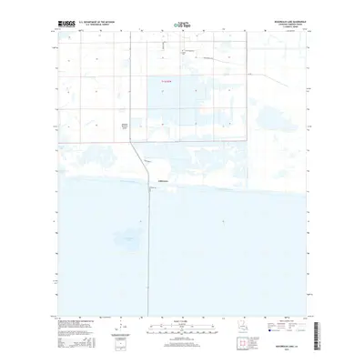
2015 Map of Boudreaux Lake
USGS Topo · Published 2015About this map
Gibbstown and the surrounding marshlands of southern Cameron Parish are defined by the critical intersection of natural hydrology and industrial infrastructure. The Intracoastal Waterway cuts a straight path through the low-lying terrain, separating the smaller Boudreaux Lake to the south from the agricultural and industrial lands to the north. Local heritage is preserved at the Granger Cem, located near the junction of Betty Murles Ln and Grangerville Rd. The map reveals a landscape heavily managed for water control and resource extraction, evidenced by the North Canal and Conoco Plant Rd. The unique topography of the region is highlighted by Savanne Neuville Island, a distinct terrain feature situated between the marshy expanses and Sweet Lake. This 2015 data reflects the modern configuration of coastal Louisiana's working landscapes.
Find a feature on this map
14 named features on this map. Tap any name to fly to it.
Don’t see what you’re looking for? This feature index may not catch every label — zoom into the map to look around manually.
Map Details
Editions of this 2015 Boudreaux Lake Map
This is the sole edition of this map. No revisions or reprints were ever made.
Other maps of this area

1932 · Lake Charles SW
USGS Topo · 1:31,680

1932 · Lake Charles SE
USGS Topo · 1:31,680

1934 · Lake Misere
USGS Topo · 1:24,000

1934 · Sweet Lake
USGS Topo · 1:24,000

1934 · Grand Bayou
USGS Topo · 1:24,000

1934 · Boudreaux Lake
USGS Topo · 1:24,000

1935 · Sweet Lake
USGS Topo · 1:31,680

1935 · Lake Misere
USGS Topo · 1:31,680

1935 · Boudreaux Lake
USGS Topo · 1:31,680

1935 · Grand Bayou
USGS Topo · 1:31,680