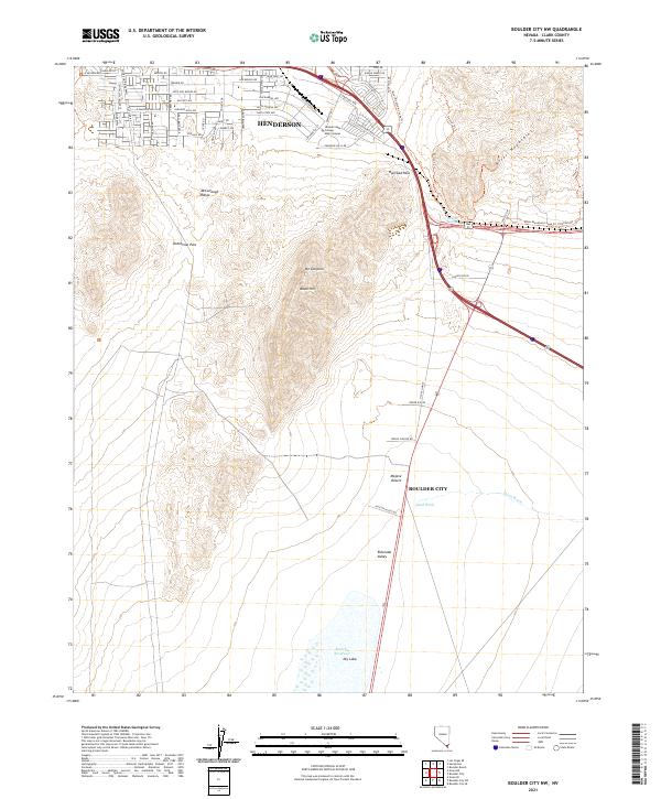
2021 Map of Boulder City NW
USGS Topo · Published 2021About this map
Henderson and Boulder City expand toward one another in this contemporary topographic record of the northern Mojave Desert. The landscape is dominated by the volcanic terrain of the McCullough Range and the River Mountains, which are separated by the strategic Railroad Pass. This high point serves as a critical corridor for regional transit and infrastructure, linking the urban developments of the Las Vegas Valley with the desert basins to the southeast. To the south, the terrain descends into the Eldorado Valley, where the Mursha Reservoir and a large Dry Lake reflect the area's arid hydrology. The presence of the Nevada State College Main Campus near Black Hill underscores the transition of this corridor from a rugged mountain crossing into a modern educational and residential hub. Numerous trails, such as the River Mountains Loop Trl and Ernie's Trl, highlight the area's recreational geography.
Find a feature on this map
53 named features on this map. Tap any name to fly to it.
Don’t see what you’re looking for? This feature index may not catch every label — zoom into the map to look around manually.
Map Details
Editions of this 2021 Boulder City NW Map
This is the sole edition of this map. No revisions or reprints were ever made.
Other maps of this area

1886 · Camp Mohave
USGS Topo · 1:250,000

1886 · Saint Thomas
USGS Topo · 1:250,000

1892 · Camp Mohave
USGS Topo · 1:250,000

1893 · Saint Thomas
USGS Topo · 1:250,000

1907 · Las Vegas
USGS Topo · 1:250,000

1908 · Las Vegas
USGS Topo · 1:250,000

1910 · Ivanpah
USGS Topo · 1:250,000

1912 · Ivanpah
USGS Topo · 1:250,000

1926 · Nelson
USGS Topo · 1:96,000

1926 · Boulder Canyon
USGS Topo · 1:96,000