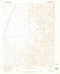
1958 Map of Boulder City SE
USGS Topo · Published 1959About this map
Lake Mead National Recreation Area dominates the eastern landscape of this 1950s survey, marking a period of federally managed land expansion in southern Nevada. The terrain is defined by the sharp descent into Oak Creek Canyon and the dry reaches of Lonesome Wash, illustrating the arid, uncompromising environment south of Boulder City. A rare water source is noted at Forlorn Hope Spring, a name that suggests the difficult conditions faced by early travelers and surveyors in the region. The map also identifies VABM 3513 Peeper, a vertical angle bench mark providing a precise elevation point for geodetic control in this high desert setting.
Find a feature on this map
7 named features on this map. Tap any name to fly to it.
Don’t see what you’re looking for? This feature index may not catch every label — zoom into the map to look around manually.
Map Details
Editions of this 1958 Boulder City SE Map
2 editions found
Other maps of this area

1886 · Camp Mohave
USGS Topo · 1:250,000

1892 · Camp Mohave
USGS Topo · 1:250,000

1926 · Nelson
USGS Topo · 1:96,000

1942 · Camp Mohave
USGS Topo · 1:250,000

1947 · Kingman
USGS Topo · 1:250,000

1948 · Kingman
USGS Topo · 1:250,000

1954 · Kingman
USGS Topo · 1:250,000

1955 · Kingman
USGS Topo · 1:250,000

1958 · Kingman
USGS Topo · 1:250,000
1958 · Boulder City SW
USGS Topo · 1:24,000