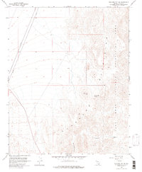
1958 Map of Boulder City SE
USGS Topo · Published 1976About this map
The Eldorado Mountains dominate this 1958 landscape, presenting a stark expanse of high desert terrain southeast of Boulder City. A significant portion of the eastern survey falls within the Lake Mead National Recreation Area, reflecting the mid-century management of these public lands. The map documents a topography defined by steep ridges and deep drainage systems, most notably Oak Creek Canyon and the evocatively named Lonesome Wash. Isolated water sources like Forlorn Hope Spring provide critical landmarks in an otherwise arid environment. A single Private road cuts across the northwest corner, but the rest of the sheet remains largely untracked, save for elevation benchmarks like VABM 3513 Peeper. This survey captures the region just as it was becoming a primary destination for desert recreation and conservation.
Find a feature on this map
10 named features on this map. Tap any name to fly to it.
Don’t see what you’re looking for? This feature index may not catch every label — zoom into the map to look around manually.
Map Details
Editions of this 1958 Boulder City SE Map
2 editions found
Other maps of this area

1886 · Camp Mohave
USGS Topo · 1:250,000

1892 · Camp Mohave
USGS Topo · 1:250,000

1926 · Nelson
USGS Topo · 1:96,000

1942 · Camp Mohave
USGS Topo · 1:250,000

1947 · Kingman
USGS Topo · 1:250,000

1948 · Kingman
USGS Topo · 1:250,000

1954 · Kingman
USGS Topo · 1:250,000

1955 · Kingman
USGS Topo · 1:250,000

1958 · Kingman
USGS Topo · 1:250,000
1958 · Boulder City SW
USGS Topo · 1:24,000