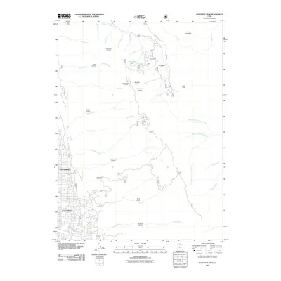
2011 Map of Bountiful Peak
USGS Topo · Published 2011About this map
Centerville and Bountiful anchor the western edge of this landscape, where residential development meets the steep rise of the Wasatch Range. The terrain is defined by a series of prominent drainage systems, including Centerville Canyon, Ward Canyon, and Holbrook Canyon, which carve through the high ground toward the valley floor. High-altitude points such as Bountiful Peak and landmarks like The Hogsback overlook a network of mountain roads including Skyline Dr and Francis Peak Rd, which provide access to remote recreational sites like the Bountiful Peak Campground. In the developed lowlands, community spaces such as Centerville Memorial Park and Lakeview Cemetery provide a record of local settlement. The map highlights the transition from suburban neighborhoods to the high-country wilderness of Farmington Flats and the Farmington Lakes, showing how the geography of Davis County is shaped by its proximity to these mountain watersheds.
Find a feature on this map
46 named features on this map. Tap any name to fly to it.
Don’t see what you’re looking for? This feature index may not catch every label — zoom into the map to look around manually.
Map Details
Editions of this 2011 Bountiful Peak Map
This is the sole edition of this map. No revisions or reprints were ever made.
Other maps of this area

1885 · Salt Lake
USGS Topo · 1:250,000

1925 · Ft. Douglas
USGS Topo · 1:125,000

1928 · Ft. Douglas
USGS Topo · 1:125,000

1950 · Fort Douglas
USGS Topo · 1:24,000

1951 · Fort Douglas
USGS Topo · 1:24,000

1951 · Salt Lake City North
USGS Topo · 1:24,000

1952 · Farmington
USGS Topo · 1:24,000

1952 · Bountiful Peak
USGS Topo · 1:24,000

1954 · Salt Lake City
USGS Topo · 1:250,000

1954 · Ogden
USGS Topo · 1:250,000