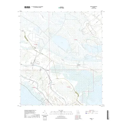
2018 Map of Bourg
USGS Topo · Published 2018About this map
Bourg sits at the intersection of water and land in this detailed landscape of Terrebonne Parish. The settlement pattern follows the banks of Bayou Terrebonne and Bayou Blue, where long, narrow land parcels radiate away from the waterways in traditional arpent style. The Intracoastal Waterway cuts a straight path across the wetlands, intersecting the winding natural bayous and the modern road network. Numerous family and parish cemeteries, such as Bisland Cem, Saint Ann Cem, and Matherne Cem, are located near the residential clusters of Klondyke and Grandbois. The presence of the Bayou Blue Bridge and various canals like the Saint-Louis Canal highlights the importance of water management and transport in this coastal environment. These features reveal a community deeply integrated with the marsh and bayou systems, where life is organized around the drainage and navigation of the low-lying terrain.
Find a feature on this map
66 named features on this map. Tap any name to fly to it.
Don’t see what you’re looking for? This feature index may not catch every label — zoom into the map to look around manually.
Map Details
Editions of this 2018 Bourg Map
This is the sole edition of this map. No revisions or reprints were ever made.
Other maps of this area

1892 · Cut-Off
USGS Topo · 1:62,500

1892 · Houma
USGS Topo · 1:62,500

1894 · Lake Felicity
USGS Topo · 1:62,500

1894 · Dulac
USGS Topo · 1:62,500

1932 · Houma SE
USGS Topo · 1:31,680

1932 · Houma SW
USGS Topo · 1:31,680

1932 · Houma NE
USGS Topo · 1:31,680

1932 · Houma NW
USGS Topo · 1:31,680

1935 · Viguerie Canal
USGS Topo · 1:31,680

1935 · Montegut
USGS Topo · 1:31,680