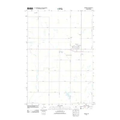
2012 Map of Bowdle
USGS Topo · Published 2012About this map
The town of Bowdle is the focal point of this 2012 survey, situated at the intersection of a established grid system and the regional aviation hub at Bowdle Municipal Airport. The municipal center is clearly defined by historical street names such as Railroad St, Depot St, and Main St, reflecting its origins and development alongside the rail line. Surrounding the town center, the landscape is dotted with several significant burial grounds, including Nell Glueckstal Cem to the north and the cluster of Redeemer Cem, Ketterling Cem, and Saint Paul Cem to the east and south. This concentration of cemeteries provides valuable documentation for genealogists tracing local families. The natural drainage of the area is represented by Swan Lake Cr, which winds through the western portion of the quadrangle among a network of rural section roads like 322nd Ave and 131st St.
Find a feature on this map
29 named features on this map. Tap any name to fly to it.
Don’t see what you’re looking for? This feature index may not catch every label — zoom into the map to look around manually.
Map Details
Editions of this 2012 Bowdle Map
This is the sole edition of this map. No revisions or reprints were ever made.
Other maps of this area

1954 · Aberdeen
USGS Topo · 1:250,000

1956 · Aberdeen
USGS Topo · 1:250,000

1974 · Gretna
USGS Topo · 1:24,000

1974 · Hoven Muni. Airport
USGS Topo · 1:24,000

1974 · Spring Lake
USGS Topo · 1:24,000

1974 · Bowdle SE
USGS Topo · 1:24,000

1974 · Bowdle
USGS Topo · 1:24,000

1978 · Hillsview SE
USGS Topo · 1:24,000

1978 · Bowdle SW
USGS Topo · 1:24,000

1978 · Bowdle-Hosmer Lake
USGS Topo · 1:24,000