
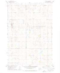
1978 Map of Bowdle SW
USGS Topo · Published 1978About this map
The rolling prairies of the Missouri Plateau dominate this landscape, split by the boundary of Walworth and Edmunds Counties. The rural character of the area is defined by its small community landmarks, including several denominational burial grounds such as the United Methodist Cem, Seventh-day Adventist Cem, and Congregational Cem. These sites, alongside a few scattered Gravel Pit operations, provide the primary markers of human settlement in a region largely dedicated to agriculture and conservation.
Find a feature on this map
13 named features on this map. Tap any name to fly to it.
Don’t see what you’re looking for? This feature index may not catch every label — zoom into the map to look around manually.
Map Details
Editions of this 1978 Bowdle SW Map
This is the sole edition of this map. No revisions or reprints were ever made.
Other maps of this area

1954 · Aberdeen
USGS Topo · 1:250,000

1956 · Aberdeen
USGS Topo · 1:250,000

1974 · Gretna
USGS Topo · 1:24,000

1974 · Hoven
USGS Topo · 1:24,000

1974 · Hoven Muni. Airport
USGS Topo · 1:24,000

1974 · Spring Lake
USGS Topo · 1:24,000

1974 · Bowdle SE
USGS Topo · 1:24,000

1974 · Bowdle
USGS Topo · 1:24,000
1978 · Tolstoy
USGS Topo · 1:24,000

1978 · Seneca NW
USGS Topo · 1:24,000