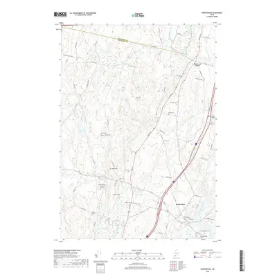
2018 Map of Bowdoinham
USGS Topo · Published 2018About this map
Bowdoinham and the surrounding riverfront of the Cathance River define this part of Sagadahoc County, where the landscape transitions from rolling hills to tidal marshlands. This survey illustrates a network of rural routes connecting historic family burial sites, including the Leonard Family Cem near Hornbeam Hill and the Purinton Cem along the Augusta Rd. The town center of Bowdoinham is situated near the confluence of local waterways, where the Denham Stream and Sedgeley Brook meet the main river channel at Patten Point.
Find a feature on this map
78 named features on this map. Tap any name to fly to it.
Don’t see what you’re looking for? This feature index may not catch every label — zoom into the map to look around manually.
Map Details
Editions of this 2018 Bowdoinham Map
This is the sole edition of this map. No revisions or reprints were ever made.
Other maps of this area

1892 · Gardiner
USGS Topo · 1:62,500

1892 · Freeport
USGS Topo · 1:62,500

1894 · Bath
USGS Topo · 1:62,500

1908 · Lewiston
USGS Topo · 1:62,500

1920 · Bath
USGS Topo · 1:62,500

1941 · Freeport
USGS Topo · 1:62,500

1942 · Lewiston
USGS Topo · 1:62,500

1943 · Gardiner
USGS Topo · 1:62,500

1944 · Freeport
USGS Topo · 1:62,500

1945 · Bath
USGS Topo · 1:62,500