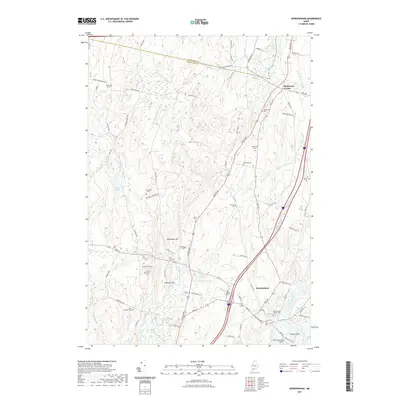
2021 Map of Bowdoinham
USGS Topo · Published 2021About this map
Bowdoinham stands at the heart of this landscape where the Cathance River and its numerous tributaries shape the rural terrain of Sagadahoc Co and Kennebec Co. The map reveals a dense network of family history markers, with more than a dozen burial grounds such as the Leonard Family Cem and the Bowdoinham Village Cem scattered across the countryside. The geography is defined by small water bodies like Caesar Pond and Stoddard Pond, while the upland areas rise toward Hornbeam Hill and Wheeler Hill. Transportation routes like the historic Augusta Rd and the more modern Interstate 95 corridor bisect the region, connecting the settlement of Richmond Corner in the north to the river-oriented community in the south. The proximity to Merrymeeting Field at Patten Point underscores the significance of the river confluence in this part of Maine.
Find a feature on this map
79 named features on this map. Tap any name to fly to it.
Don’t see what you’re looking for? This feature index may not catch every label — zoom into the map to look around manually.
Map Details
Editions of this 2021 Bowdoinham Map
This is the sole edition of this map. No revisions or reprints were ever made.
Other maps of this area

1892 · Gardiner
USGS Topo · 1:62,500

1892 · Freeport
USGS Topo · 1:62,500

1894 · Bath
USGS Topo · 1:62,500

1908 · Lewiston
USGS Topo · 1:62,500

1920 · Bath
USGS Topo · 1:62,500

1941 · Freeport
USGS Topo · 1:62,500

1942 · Lewiston
USGS Topo · 1:62,500

1943 · Gardiner
USGS Topo · 1:62,500

1944 · Freeport
USGS Topo · 1:62,500

1945 · Bath
USGS Topo · 1:62,500