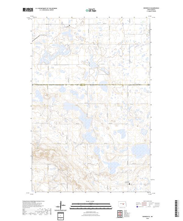
2024 Map of Bowdon SE
USGS Topo · Published 2024About this map
The prairie landscape at the intersection of Wells and Kidder counties is defined by its extensive wetlands and conservation lands. The Wells County Waterfowl Production Area and the Kidder County Waterfowl Production Area dominate the topography, preserving a network of potholes and marshes characteristic of the North Dakota drift plain. Settlement patterns here are sparse, with the rural character maintained by a grid of section roads like Co Rd 70 and 9th St SE. Genealogists and local historians will find the northern and southern edges of this area anchored by two significant burial sites: the Bowdon Advent Cem in the north and the Seventh Day Adventist Cem to the south. Aviation history is represented by the inclusion of the Buchmiller Airport, a small private facility situated among the scattered lakes and waterfowl habitats.
Find a feature on this map
22 named features on this map. Tap any name to fly to it.
Don’t see what you’re looking for? This feature index may not catch every label — zoom into the map to look around manually.
Map Details
Editions of this 2024 Bowdon SE Map
This is the sole edition of this map. No revisions or reprints were ever made.
Other maps of this area

1951 · Bowdon
USGS Topo · 1:24,000

1951 · Heaton
USGS Topo · 1:24,000

1951 · Sykeston
USGS Topo · 1:24,000

1952 · New Rockford
USGS Topo · 1:250,000

1956 · New Rockford
USGS Topo · 1:250,000

1971 · New Rockford
USGS Topo · 1:250,000

1972 · Lake Williams
USGS Topo · 1:24,000
1972 · Woodworth NW
USGS Topo · 1:24,000

1972 · Des Moines Lake
USGS Topo · 1:24,000

1978 · Wagon Wheel Hill
USGS Topo · 1:24,000