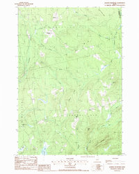
1988 Map of Bowers Mountain
USGS Topo · Published 1988About this map
Prentiss and the rural crossroads of Thompson Corners anchor this late-1980s landscape at the border of Penobscot and Washington Counties. The area is defined by a dense network of brooks and ridges, where the high ground of Bowers Mountain and Tolman Hill overlooks the low-lying Lindsey Bog. A pattern of small-scale settlement persists near Carroll, where local landmarks like the Gates Hill area and multiple cemeteries suggest deep-rooted family ties in this timber-rich region. Economic activity is evidenced by scattered gravel pits and a radio tower, while the winding Mattagodus Stream and Baskahegan Stream dictate the movement across the townships of Prentiss Plt and Carroll Plt. The map reveals a transition between managed forest lands and the quiet residential pockets that have survived in this corner of Down East Maine.
Find a feature on this map
36 named features on this map. Tap any name to fly to it.
Don’t see what you’re looking for? This feature index may not catch every label — zoom into the map to look around manually.
Map Details
Editions of this 1988 Bowers Mountain Map
This is the sole edition of this map. No revisions or reprints were ever made.
Other maps of this area

1931 · Springfield
USGS Topo · 1:48,000

1934 · Springfield
USGS Topo · 1:62,500

1940 · Danforth
USGS Topo · 1:62,500

1941 · Danforth
USGS Topo · 1:62,500

1941 · Scraggly Lake
USGS Topo · 1:62,500

1941 · Wytopitlock
USGS Topo · 1:62,500

1943 · Danforth
USGS Topo · 1:62,500

1943 · Wytopitlock
USGS Topo · 1:62,500

1944 · Scraggly Lake
USGS Topo · 1:62,500

1954 · Millinocket
USGS Topo · 1:250,000