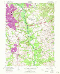
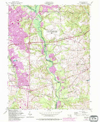
1957 Map of Bowie
USGS Topo · Published 1971About this map
The Patuxent River and its meandering tributaries, including White Marsh Branch and Collington Branch, define the rural and emerging suburban landscape of Prince George's and Anne Arundel counties in this mid-century survey. Urban expansion around Bowie is clearly visible through 1970 photorevisions, contrasting with established rural settlements like Davidsonville and Stocketts. The map documents a transition from an agricultural and gravel-mining economy—evidenced by numerous Gravel Pits and a Borrow Pit—to a more connected regional hub via the John Hanson Highway and Defense Highway. Local life is anchored by historic community centers such as Sacred Heart Ch and St Pauls Ch, alongside specialized landmarks like the Bowie Race Track Stables. The presence of the U S Military Reservation Air Force Transmitter Station indicates the area's strategic importance during the Cold War era.
Find a feature on this map
64 named features on this map. Tap any name to fly to it.
Don’t see what you’re looking for? This feature index may not catch every label — zoom into the map to look around manually.
Map Details
Editions of this 1957 Bowie Map
5 editions found
Other maps of this area

1892 · Laurel
USGS Topo · 1:62,500

1892 · Owensville
USGS Topo · 1:62,500

1894 · Laurel
USGS Topo · 1:62,500

1894 · Relay
USGS Topo · 1:62,500

1895 · Owensville
USGS Topo · 1:62,500

1897 · Laurel
USGS Topo · 1:62,500

1899 · Patuxent
USGS Topo · 1:125,000

1900 · Washington
USGS Topo · 1:62,500

1905 · Owensville
USGS Topo · 1:62,500

1906 · Patuxent
USGS Topo · 1:125,000