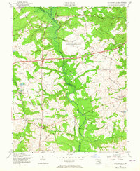
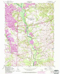
1957 Map of Davidsonville
USGS Topo · Published 1965About this map
The Patuxent River winds through the heart of the Maryland countryside, serving as the border between Anne Arundel and Prince Georges counties. In this mid-century period, the landscape is defined by its rural crossroads and agricultural character, punctuated by historic religious centers such as Sacred Heart Ch and All Hallows Chapel. Traditional transportation routes like Governor Bridge Road and Queen Anne Road intersect with modern infrastructure projects of the era, notably the John Hanson Highway and the Defense Highway. Local life centers around small settlements like Mitchellville (Mullikin) and Davidsonville, while the U S Military Reservation Air Force Transmitter Station indicates the region's strategic proximity to the capital. Numerous Sand and Gravel Pits along the river banks point to the extractive industries supporting the area's mid-century growth.
Find a feature on this map
62 named features on this map. Tap any name to fly to it.
Don’t see what you’re looking for? This feature index may not catch every label — zoom into the map to look around manually.
Map Details
Editions of this 1957 Davidsonville Map
5 editions found
Other maps of this area

1892 · Laurel
USGS Topo · 1:62,500

1892 · Owensville
USGS Topo · 1:62,500

1894 · Laurel
USGS Topo · 1:62,500

1894 · Relay
USGS Topo · 1:62,500

1895 · Owensville
USGS Topo · 1:62,500

1897 · Laurel
USGS Topo · 1:62,500

1899 · Patuxent
USGS Topo · 1:125,000

1900 · Washington
USGS Topo · 1:62,500

1905 · Owensville
USGS Topo · 1:62,500

1906 · Patuxent
USGS Topo · 1:125,000