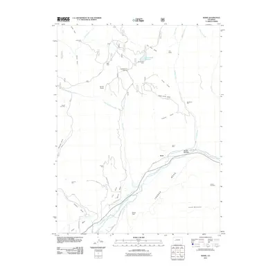
2011 Map of Bowie
USGS Topo · Published 2011About this map
The North Fork Gunnison River carves through the lower portion of this landscape, serving as a corridor for both water and industry near the settlement of Bowie. This area is defined by its deep connection to coal mining, with several operations such as Bowie Mine, Farmers Mine, and Orchard Valley Mine situated along the river and nearby gulches. These industrial sites are linked by a network of specialized routes including Farmers Mine Rd and Bowie Rd, illustrating the importance of extraction to the local economy.
Find a feature on this map
52 named features on this map. Tap any name to fly to it.
Don’t see what you’re looking for? This feature index may not catch every label — zoom into the map to look around manually.
Map Details
Editions of this 2011 Bowie Map
This is the sole edition of this map. No revisions or reprints were ever made.
Other maps of this area

1938 · Mt. Gunnison
USGS Topo · 1:48,000

1945 · Mount Gunnison
USGS Topo · 1:62,500

1956 · Montrose
USGS Topo · 1:250,000

1957 · Leadville
USGS Topo · 1:250,000

1959 · Leadville
USGS Topo · 1:250,000

1959 · Montrose
USGS Topo · 1:250,000

1960 · Leadville
USGS Topo · 1:250,000

1960 · Montrose
USGS Topo · 1:250,000

1961 · Electric Mountain
USGS Topo · 1:24,000

1961 · Chalk Mountain
USGS Topo · 1:24,000