1968 Map of Bowman-Haley Dam
USGS Topo · Published 1971About this map
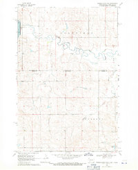
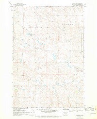
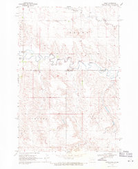
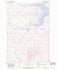
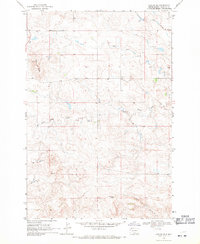
Bowman-Haley Reservoir dominates the northwestern corner of this landscape, its creation having altered the flow of the North Fork Grand River as it winds through the plateau. Located directly on the border between North Dakota and South Dakota, the area is characterized by scattered landmarks essential to rural life in the late 1960s. Genealogists will find the Haley Cem and St Isidore Cem positioned across the landscape, while the Vessey Sch and the namesake Vessey Lake anchor the southern portion of the survey. The terrain is marked by distinct geological zones such as Goldfield and Vessey, interspersed with small-scale industrial sites like a Gravel Pit and natural water features including a Flowing Well and Wilson Creek.
Find a feature on this map
14 named features on this map. Tap any name to fly to it.
Don’t see what you’re looking for? This feature index may not catch every label — zoom into the map to look around manually.
Map Details
Editions of this 1968 Bowman-Haley Dam Map
This is the sole edition of this map. No revisions or reprints were ever made.
Other maps of this area

1935 · Reva
USGS Topo · 1:125,000

1953 · Dickinson
USGS Topo · 1:250,000

1954 · Lemmon
USGS Topo · 1:250,000

1957 · Dickinson
USGS Topo · 1:250,000

1957 · Lemmon
USGS Topo · 1:250,000
1968 · Ralph SW
USGS Topo · 1:24,000
1968 · Haley
USGS Topo · 1:24,000
1968 · Tepee Buttes
USGS Topo · 1:24,000
1968 · Ludlow SE
USGS Topo · 1:24,000

1968 · Ralph
USGS Topo · 1:24,000