
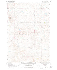
1968 Map of Ludlow SE
USGS Topo · Published 1971About this map
Ashcroft Butte and Flint Butte dominate this Harding County landscape, rising above a network of drainages that once supported livestock and small homesteads. The terrain is defined by the winding paths of Big Nasty Creek, Coal Bank Creek, and Horse Creek, illustrating the complex water patterns in this part of South Dakota. Human impact is evidenced by a small-scale Mine near the northwestern butte and the presence of the Lanesboro Sch in the northeast, marking a point of community assembly for rural families during the late 1960s. The map also records fine red dashed lines indicating fence and field boundaries as they appeared during 1964 aerial photography, offering a detailed view of grazing land management and property lines in this high-plains environment.
Find a feature on this map
11 named features on this map. Tap any name to fly to it.
Don’t see what you’re looking for? This feature index may not catch every label — zoom into the map to look around manually.
Map Details
Editions of this 1968 Ludlow SE Map
2 editions found
Other maps of this area

1935 · Reva
USGS Topo · 1:125,000

1954 · Lemmon
USGS Topo · 1:250,000

1957 · Lemmon
USGS Topo · 1:250,000

1968 · Eagles Nest Butte
USGS Topo · 1:24,000

1968 · Ralph SW
USGS Topo · 1:24,000

1968 · Bowman-Haley Dam
USGS Topo · 1:24,000

1968 · Ludlow
USGS Topo · 1:24,000

1968 · Tepee Buttes
USGS Topo · 1:24,000

1969 · Reva NW
USGS Topo · 1:24,000
1971 · Sheep Pen Draw
USGS Topo · 1:24,000